If you’re looking for a high-altitude hiking adventure that combines surreal landscapes, wide alpine views, and minimal crowds, then the Mt. Satima Hike in Kenya’s Aberdare Ranges should be high on your bucket list. Known for its unique rock formations called the Dragon’s Teeth, Mt. Satima offers a rewarding, moderately challenging hike that’s ideal for Kenyan hikers and international adventurers alike.
Located within Aberdare National Park, Mt. Satima (also known as Ol Donyo Le Satima) stands as the third-highest mountain in Kenya, reaching an impressive 4,001 meters (13,127 feet) above sea level. It’s a true gem for trekkers seeking solitude, striking views, and a unique highland ecosystem.
Table of Contents
Why Hike Mt. Satima?
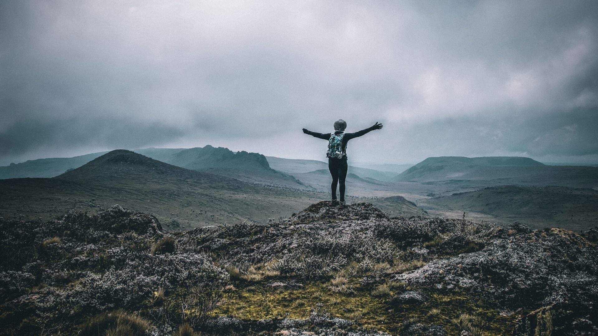
Unlike the more rugged Mt. Kenya or the popular Elephant Hill, Mt. Satima is less traveled, offering a tranquil hiking experience that feels untouched and wild. The trail to the summit winds through alpine moorlands, heather-covered ridges, and the mysterious Dragon’s Teeth rock formations—a fantasy-like stretch of jagged stones that rise dramatically from the earth like something out of a Tolkien novel.
This hike is perfect for:
- Hikers training for Mt. Kenya or Kilimanjaro
- Nature lovers looking for rare plants and birds
- Photography enthusiasts craving wide landscapes
- Tourists seeking an off-the-beaten-path adventure in Kenya
Trail Information
- Starting Point: Wandare Gate (or Shamata Gate depending on route)
- Distance: ~14–16 kilometers round trip
- Hiking Time: 5–8 hours depending on pace and rest stops
- Elevation Gain: Starts at ~3,200 meters and ascends to 4,001 meters
- Difficulty: Moderate to challenging (due to altitude, not terrain)
🏞️ Ready to Conquer New Heights? 🏔️
🚀 Join Joe Photography and Safaris for thrilling hiking adventures across Kenya! Meet new friends, explore breathtaking trails, and create unforgettable memories. 🌿✨
🎒 Join Our Hiking WhatsApp Group 🚀Hikes. Adventures. Friendships. Memories. 🌍
What to Expect on Mt. Satima Hiking Trail
The trail begins with gradual elevation across open alpine moorland. It’s relatively gentle, but the high altitude means you’ll feel the climb sooner than expected. About an hour in, the Dragon’s Teeth rise in the distance, creating a surreal visual marker.
The path can be boggy and slippery during the rainy season, so sturdy waterproof boots are a must. From the Dragon’s Teeth, the trail becomes slightly steeper as you ascend to the summit ridge. You may encounter mist, strong winds, and dramatic cloud formations—adding to the mystique of the mountain.
Expect limited to no mobile network, no vendors, and zero human interference. It’s raw wilderness—exactly as it should be.
How to Get to Mt. Satima
Mt. Satima is located about 180 km from Nairobi, a 3.5–4 hour drive depending on the route you choose. Most hikers use the Wandare Gate (via Mweiga-Nyahururu road) or Shamata Gate (via Nyahururu).
We recommend using a 4×4 vehicle, especially during the rainy season. If you’re booking with Joe Photography and Safaris, we provide reliable round-trip transport, including park fees, guides, and group coordination.
The Mt. Satima hike isn’t just a physical challenge—it’s a rich ecological and geological journey through one of Kenya’s most pristine highland environments. Below are the key highlights, each offering a unique dimension to the hike, both in terms of physical terrain and visual experience.
Dragon’s Teeth – A Geological Marvel at 3,600m
The Dragon’s Teeth are a cluster of jagged, volcanic rock spires that dominate the moorland landscape approximately 6–7 kilometers into the trail. Formed from ancient lava flows and shaped by years of erosion, these basalt formations resemble the serrated spine of a mythical beast—hence the name.
Technical Details for Hikers:
- Elevation: ~3,600 meters above sea level
- Location: Midway between the trailhead and summit, roughly 1.5–2 hours into the hike
- Terrain: Rocky, uneven ground; soft moorland vegetation; occasional bogs during wet seasons
- Trail Type: Open ridgeline with clear footpaths and low vegetation cover
- Photography Tip: Best lighting occurs mid-morning before clouds roll in; use wide-angle lenses to capture scale and contrast with surrounding grasslands.
What to Expect:
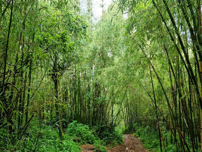
Expect a sudden change in landscape as the bamboo and heather give way to open ground scattered with giant rocks. The area is typically breezy and offers vantage points for panoramic shots or short breaks. For geology enthusiasts, the formations provide insight into the volcanic history of the Aberdare Range, believed to be active over 10 million years ago.
Alpine Moorlands – Kenya’s Highland Tundra
The stretch between the Dragon’s Teeth and the summit takes hikers through true Afro-alpine moorland, a unique ecological zone characterized by extreme weather, stunted vegetation, and vast openness. This zone supports plant and bird species specially adapted to low oxygen levels, high UV exposure, and cold night temperatures.
Flora:
- Giant Lobelia (Lobelia deckenii): Retains water to survive nightly freezes
- Senecio species (giant groundsels)
- Heather (Erica arborea): Covers much of the ground; tough and woody
- Everlastings and alpine mosses
Fauna:
- Jackson’s Francolin and Mountain Yellow Warbler
- Malachite Sunbird feeding on lobelia nectar
- Occasional sightings of eland, mountain reedbuck, and African hare
Technical Tips for Hikers:
- Altitude: Elevations range from 3,500m to 3,950m in this zone
- Trail Conditions: Can be wet and boggy after rains; lightweight waterproof boots are essential
- Temperature: Expect temperatures between 4°C to 12°C, colder with wind chill
- Health Note: This is often where mild altitude symptoms (dizziness, shortness of breath) may begin. Take slower, deliberate steps, and stay hydrated.
Pro Hiking Tip: The moorland is exposed, so bring a windbreaker and gloves. Don’t underestimate the UV intensity—sunburn is common even on cloudy days.
360-Degree Views from the Summit – 4,001m Above Sea Level
The Mt. Satima summit, standing at 4,001 meters (13,127 feet), is the third-highest peak in Kenya after Batian and Nelion of Mt. Kenya. The summit itself is relatively flat and grassy, surrounded by low-lying outcrops and moss-covered rocks. A small cairn or marker typically identifies the true peak.
What You’ll See on a Clear Day:
- Mount Kenya’s glacier-capped peaks to the northeast
- The Laikipia plains and Ol Pejeta Conservancy
- Deep valleys and ridges of the Aberdare Range
- Lake Ol Bolossat shimmering in the distance
- Occasionally, you can spot Mount Longonot or the Kilimambogo massif to the south
Technical Details:
- Distance from Trailhead: ~7–8 km
- Final Ascent: Gentle, gradual rise with scattered rocks; not technically difficult
- Time to Reach: ~3–4 hours from trailhead at moderate pace
- Visibility: Often affected by mist and fast-moving clouds; best views are before noon
Summit Tips:
- Dress in layers—temperatures can drop below freezing with wind chill
- Keep summit stops short in windy conditions to avoid hypothermia
- Don’t forget to sign the summit logbook if available, and capture your summit photo with a wide-angle lens for maximum backdrop drama
Safety Note: Weather at the summit can change rapidly. Watch for rolling fog and potential thunderstorms in the afternoon.
What to Bring during Mt. Satima Hike
Here’s a checklist of essentials for your Mt. Satima hike:
- Hiking boots (waterproof with ankle support)
- Backpack with hydration pack
- Warm layers – it gets cold quickly at 4,000m
- Rain jacket or poncho
- Snacks and packed lunch
- Sunscreen, hat, gloves
- Camera or smartphone
- Trekking poles (recommended)
- Altitude medication (if sensitive)
Wildlife and Conservation
Though sightings aren’t always guaranteed, Mt. Satima is home to buffalos, eland, bushbuck, and a variety of birds including jackals and vultures. It’s a key conservation area managed by Kenya Wildlife Service (KWS), and hikers are advised to maintain minimal impact and respect the fragile alpine ecosystem.
Hiking with Joe Photography and Safaris
Whether you’re an individual traveler or part of a hiking group, Joe Photography and Safaris ensures a seamless Mt. Satima adventure. Our packages include:
- Professional hiking guides
- Reliable 4×4 transport from Nairobi or Nakuru
- Entrance and KWS park fees
- Professional photography throughout your hike
- Medical kit and support
- Access to our active WhatsApp hiking group for updates
We specialize in curated hikes that combine safety, comfort, and stunning photo memories—all while supporting local guides and conservation.
FAQs on Mt. Kenya Hike
How difficult is the Mt. Satima hike?
The Mt. Satima hike is considered moderate to challenging, mainly due to its high altitude (up to 4,001 meters above sea level). The trail itself isn’t technically difficult, but the elevation can cause fatigue and mild altitude symptoms. Proper acclimatization, hydration, and pacing are key to completing the hike comfortably.
Where is Mt. Satima located in Kenya?
Mt. Satima is located in the Aberdare National Park, within the central highlands of Kenya, near Nyandarua County. The most common access points are via the Wandare Gate or Shamata Gate, both reachable from Nairobi in about 3.5 to 4 hours by road.
What is the best time to hike Mt. Satima?
The best time to hike Mt. Satima is during the dry seasons:
January to March
June to October
These months offer clearer skies, firmer trails, and better visibility at the summit. The moorlands can be boggy during rainy seasons, making hiking more difficult.
What should I bring for the Mt. Satima hike?
For a successful Mt. Satima hike, bring:
Waterproof hiking boots
Warm layered clothing
Rain jacket or poncho
Packed snacks and 2+ liters of water
Trekking poles
Sunscreen and a hat
Camera for the scenic views and Dragon’s Teeth
Optional: Altitude medication for those prone to high-altitude sickness.
Do I need a guide or permit to hike Mt. Satima?
Yes. Since Mt. Satima is within Aberdare National Park, hikers must pay Kenya Wildlife Service (KWS) park entry fees and are encouraged to hike with a certified guide for safety. Booking through a trusted operator like Joe Photography and Safaris ensures transport, permits, and an experienced guide are all taken care of.


